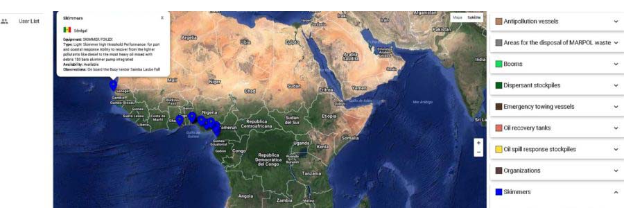
In the framework of its activities to improve emergency response and protection of marine environment, MARENDA project developed a GIS database of available tools and equipment for oil spill response at WCA region. This tool was designed in a way that allows to introduce information from all the Western and Central African coastal countries. The GIS inventory information is only available to registered users. CETMAR (MARENDA coordinator) is acting as administrator of the application, providing access to users based on indications of the WCA focal points designated to administer the information at country level. Link to GIS